Malvar (Malvar)
 |
The municipality was named after General Miguel Malvar, one of the last Filipino generals to surrender to the Americans during the Philippine-American War in 1902. The Municipality comprises 15 barangays and 3 sitios.
Located 37 km from Batangas City and 68 km south of Manila and accessible by the STAR Tollway, Malvar is surrounded by Tanauan City to the north, Santo Tomas City to the east, Lipa City to the south and Balete to the west. With the expansion of Metro Manila, Malvar is now part of the Manila conurbation (which reaches Lipa City).
According to Ferdinand Blumentritt who wrote many articles about Philippine history which were published in Boletin de la Sociedad Geografica in Madrid, Spain in 1866, Malvar's history dates back to 1300 AD when Datu Puti, a member of the Ten Datus who escaped from Sultan Makatunao of Borneo, settled in what is now the province of Batangas. His descendants inhabited Laguna, Cavite, Bicol Region, and in our place, then known as Luta.
Luta was formerly a barrio of the Municipality of Lipa, now Lipa City. When Luta was created to become an independent municipality, it included the adjoining barrios of Payapa, Kalikangan, San Gallo, and Bilukaw. As time went by, these original barrios were divided and were given other names. Payapa was divided and became San Fernando, Santiago, and Bagong Pook. Kalikakan became the barrios of San Andres and San Juan. San Gallo became the barrios of San Pioquinto, San Pedro (including Sitio Calejon) and Bilucaw became San Isidro and Bilucao. These names given to each barrio were based on the names of the locality's most powerful or honored man.
Luta retained its name perhaps due to its exciting and very memorable legend. It was said that the name Luta came from the name of a beautiful maiden, Dayang-Dayang, the youngest daughter of Datu Banga, a descendant of Datu Puti, then the chief of the tribe.
She was the most beautiful lady in the place. Loved and cherished by the inhabitants, she fell in love with a Chinese named Ling and was about to be married when her elder sister Kampupot took interest in her fiancé. Out of the treachery and jealousy of her sister, Luta was executed and died in the arms of her Chinese lover. From then on, the place was named Luta in her honor.
Luta's march toward becoming a municipality could never be ignored. For this is where the seeds and the sentiments of becoming one were sown. This is where the Samahang Mag-aararo, the acknowledged pioneers of this movement was organized. They were Mariano R. Lat, Gregorio Leviste, Miguel L. Aranda, Simeon Esleigue, Constancio Manalo, Pedro Lat-Torres, Nicasio Gutierrez, Gregorio Villapando, Estanislaw Lat, Pelagio Wagan, Sebastian Trinidad and Julian Lantin. Through its dynamic organizers and members, the first steps to make the locality a municipality were made. It was in Luta where the seat of the Municipal Government was situated.
With their (The Samahang Mag-aararo) devotion, patience, and perseverance and with the help of the Honorable Teodoro M. Kalaw, former Secretary of the Interior, Malvar was finally created a municipality by a proclamation by the acting Governor-General of the Philippines Honorable Charles B. Yeater, on the 16th day of December 1918. The proclamation took effect on January 10, 1919, on the same day the municipality was inaugurated.
In honor of the late General Miguel Malvar, the town was named the last Filipino general to surrender to the Americans.
Map - Malvar (Malvar)
Map
Country - Philippines
 |
 |
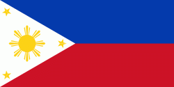
| Flag of the Philippines | |
Negritos, some of the archipelago's earliest inhabitants, were followed by successive waves of Austronesian peoples. Adoption of animism, Hinduism and Islam established island-kingdoms called Kedatuan, Rajahnates, and Sultanates. The arrival of Ferdinand Magellan, a Portuguese explorer leading a fleet for Spain, marked the beginning of Spanish colonization. In 1543, Spanish explorer Ruy López de Villalobos named the archipelago Las Islas Filipinas in honor of Philip II of Spain. Spanish settlement through Mexico, beginning in 1565, led to the Philippines becoming ruled by the Spanish Empire for more than 300 years. During this time, Catholicism became the dominant religion, and Manila became the western hub of trans-Pacific trade. In 1896, the Philippine Revolution began, which then became entwined with the 1898 Spanish–American War. Spain ceded the territory to the United States, while Filipino revolutionaries declared the First Philippine Republic. The ensuing Philippine–American War ended with the United States establishing control over the territory, which they maintained until the Japanese invasion of the islands during World War II. Following liberation, the Philippines became independent in 1946. Since then, the unitary sovereign state has often had a tumultuous experience with democracy, which included the overthrow of a decades-long dictatorship by a nonviolent revolution.
Currency / Language
| ISO | Currency | Symbol | Significant figures |
|---|---|---|---|
| PHP | Philippine peso | ₱ | 2 |
| ISO | Language |
|---|---|
| EN | English language |
| TL | Tagalog language |


